Breathtaking
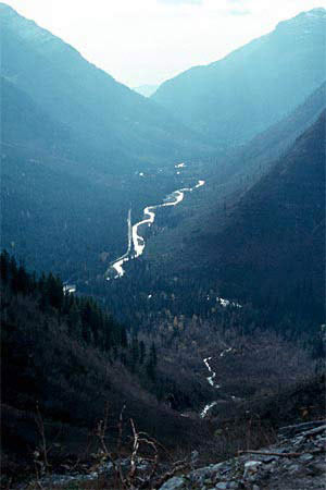
view from a point half way or so up (or down) the Going-To-The-Sun Highway. That
bit of highway that runs straight up the center of the photo has a couple of objects
identifiable in the original scan (2000 by 3000 pixels, 2400 dpi from a Fujichrome
slide) as cars.
Lake McDonald is beyond that last mountain on the right
(Mount Vaught, 8860 ft.). The "river" is McDonald Creek, and there is
a campground called "Avalanche Creek" at its edge, where the eponymous
tributary joins it just around that last bend. At one of the several places we
stopped to enjoy the play of near-freezing green water as it rushed down the valley
there was a bird who dove beneath the surface in search of food. Some kind of
thresher, I think. What a way to make a living.
We were here a few days
after the park was officially closed to tourism, a few days before access to the
highway was closed by a real storm. Last week of October, or some time near then.
It was a great contrast to Yosemite, where even in mid-week there was a half-hour
cruise through packed lots in search of parking.
Back
to GLACIER One

