|
Click the picture to return to Playas Road Races page
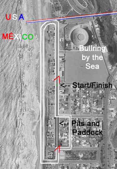
An aerial view (USGS) of Playas de Tijuana, México, overlaid
by a course diagram. I have copies of the original diagram supplied to racers. They were duplicated on a mimeo machine and
showed street widths which I measured from curb to curb. I designed the course to incorporate two right turns. The previous
layouts had been all left handers, kind of a long, squared oval.
During the rain race a formula car missed the north
turn, hit the curb and vaulted the two-strand barbed wire fence at the borderline. Several spectators and a couple of flagmen
slogged through the mud, righted the car and dragged it back into Mexico. Quite a set of tracks for the Border Patrol specialists
to figure out.
|